


Delivery robots that once stalled every few seconds on crowded sidewalks are now navigating chaotic city streets in real time, thanks to an artificial intelligence (AI) shift borrowed directly from large language models (LLMs).
For years, robotics relied on rule-based systems: sensors built a map, a robot located itself on that map, detected every object around it, then followed a hand-written rule for each one.
That approach could not keep pace with real streets, where pedestrians, cyclists and cars move unpredictably, and it left machines stuck waiting rather than moving.
“The traditional robotics stack would have you use lidar or cameras to create a map, then localize yourself within it, detect every object and build rules to create a path around it,” said Zach Rash, chief executive and co-founder of Coco Robotics.
“But you’re always surrounded by people on e-bikes, people in cars, people walking,” he said. “It’s very dynamic, so creating those rules is impossible.”
“The architecture behind the LLMs translates into robotics,” he said. “We have millions of hours of driving in these environments, and that can be used to train a reliable self-driving model on the robots.”
“There is this Cambrian explosion of robotic capability that’s being driven by advances in the language models and the kinds of AI we all use to do knowledge work,” said John Hanke, executive chairman of Niantic Spatial. “It’s led to this revolutionary period where robots are capable of doing things today that they couldn’t do a year or two years ago.”
Rash said his team already held the driving data those models needed, because Coco set a high quality-of-service bar from the start. In the company’s first few years, humans teleoperated the vehicles rather than deploy them untested, quietly building the real-world dataset the models would later train on.
“Teleops has historically been this taboo thing that no one wants to talk about, but you need a great data set in the real world, and the best way to create that data set is to provide actual value,” he said. “So you can continue to collect that data and iterate.”
He said Niantic Spatial’s mapping is the other half of the equation, since the maps a robot needs differ from the maps a person needs, and its team also has to solve for something closer to human intuition about drop-offs.
That combination of driving data and precise maps is why Niantic Spatial and Coco Robotics formalized a partnership in March, putting Niantic Spatial’s mapping technology directly into Coco’s delivery fleet.
Building the living map
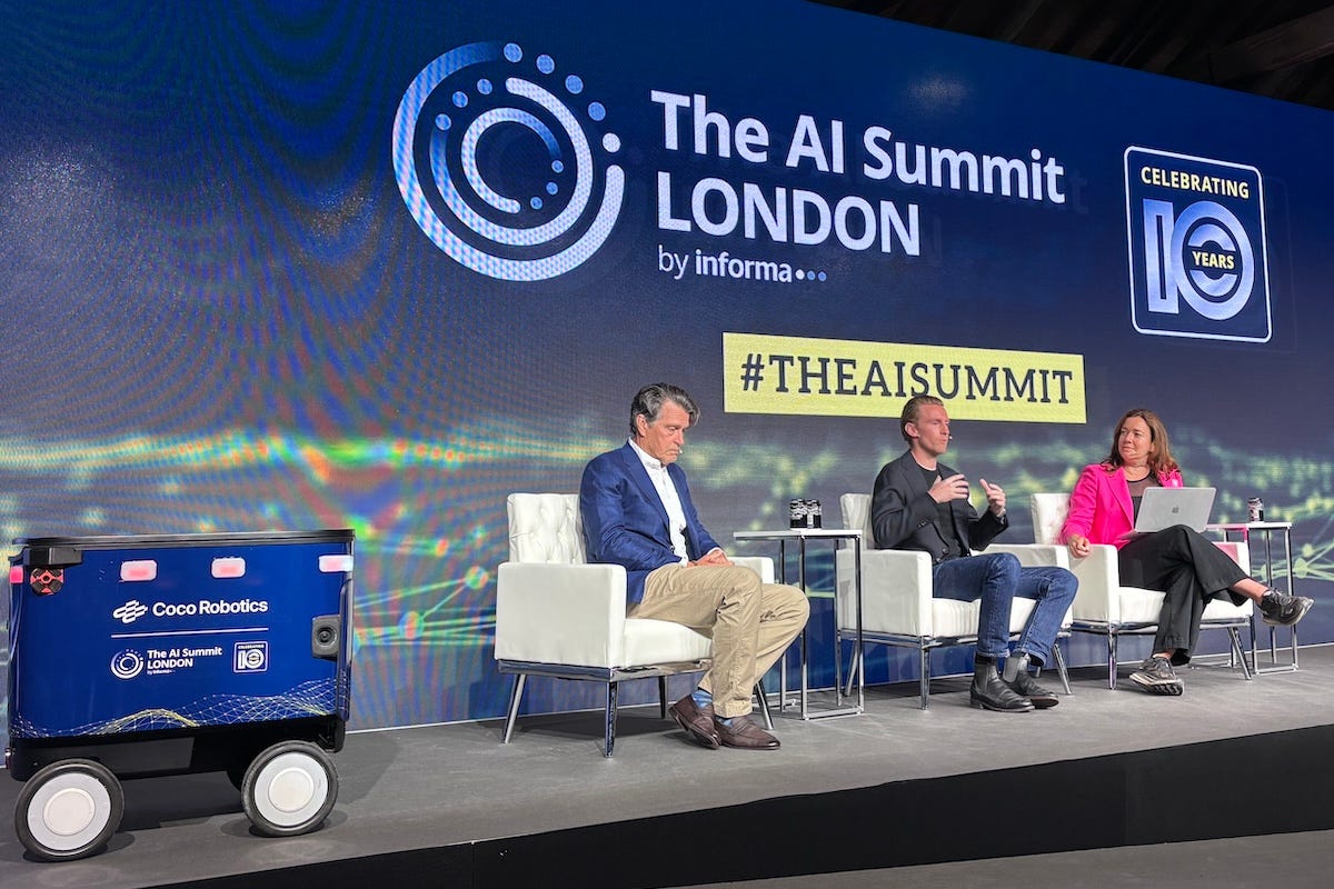
The pair discussed the shift at The AI Summit London in June, during a panel titled “Modeling Reality: When AI Leaves the Cloud and Starts Walking the Streets.” Informa Tech organized the event in London, and Stephanie Hare, a researcher and co-presenter of the BBC series “Artificial Intelligence: Decoded,” moderated.
Rash co-founded Coco Robotics to build small vehicles for last-mile delivery in dense cities. Hanke spent a decade at Google building out Google Earth and Google Maps before founding Niantic, the company behind Pokémon Go.
Niantic sold its games division to Scopely for $3.5 billion in 2025. The remaining business became Niantic Spatial, a geospatial AI company Hanke now chairs.
Hanke said the trajectory toward precise maps began at Google, adding satellite imagery, aerial photos and Street View’s ground-level detail. Pokémon Go sat on that foundation, but he said its real origin was personal.
“The genesis of Pokémon Go was me as a parent. I had three kids who were into computer games, and I wanted to get them outside, so I thought it’d be awesome to combine game playing with being outside,” he said.
Exploring augmented reality, layering digital objects into glasses, later demanded even more precision.
“You want to be able to place things in the world within a centimeter. You want to be able to measure that error in centimeters,” he said.
Hanke said that extra detail came from players who opted in to scan an area and upload images, which were turned into 3D maps accurate enough to place game characters exactly, without collecting anyone’s data without consent. That pipeline, now expanded to drones and other imagery, feeds Coco’s delivery fleet.
Rash said the appeal is sharpest in extreme weather.
“When we met with the Finnish regulators, their comment to us was that these winters took down the Russian army. Are you sure you want to launch here? And we confidently said yes, we’re sure,” he said.
Coco has since expanded into three or four Finnish cities, alongside Los Angeles, Chicago, Miami, North Jersey and the Bay Area, running more than 1,000 vehicles as of the panel.
“We’re the most useful for our partners in markets with extreme weather,” Rash said. “When it’s cold and dangerous to be outside on a bike, demand for the service goes up because people don’t want to leave their house.”
“But courier supply goes down because it’s unsafe or unpleasant to deliver in those conditions. You get this big supply and demand imbalance, and robots can be helpful to keep a reliable service running,” he added.
He said the vehicles are built to be fully submersible, which matters in Miami’s routine heavy rain, and that the same logic held during the Los Angeles wildfires, when poor air quality made it risky for human couriers to work outside.
Winning trust on sidewalks
Rash said the vehicle’s design was engineered around trust as much as logistics: shoulder width so it will not block a sidewalk, narrow enough for bike lanes at speed, and sized for about four grocery bags or eight to ten extra-large pizzas.
“The robot’s pink. We named the company Coco after a ten-second naming exercise: we looked up cute dog names, and Coco was number one,” he said. “We wanted it to feel like this warm, friendly part of the community, more like a Wall-E, without feeling like this imposing piece of technology.”
“We’ve been in Los Angeles the longest, and it’s completely normalized there: people don’t call it a robot. They call it a Coco, and that was intentional in how we designed it.”
“It’s locked, first of all. We’ve done millions of miles of deliveries across LA and Chicago, and some of these areas have higher crime rates, and we just haven’t seen much vandalism,” he said. “We’ve never had any thefts of the vehicles. They weigh about 150 pounds, so it’s a little awkward to pick up, and they have dual locks on the lid.”
Cities often ask whether Coco will see the vandalism that hit micromobility devices like e-scooters. It has not, largely because the vehicle shuttles between merchant and customer rather than sitting on the street, and because people treat it as part of a business they already trust.
Rash said the deeper problem is capacity, not manners: delivery keeps growing faster than the pool of human drivers, especially for perishable orders, and robots fit a city’s infrastructure better than more cars or e-bikes because they are:
small and lightweight
quiet
extremely energy efficient
inherently safer by design
“On a sidewalk, we’re designed to be the most yielding and most respectful pedestrian. We have maps of these cities to identify the most underutilized parts of the infrastructure to use,” he said.
“We’ve had this 4,000-pound solution of the automobile for the past 100 years, a one-size-fits-all vehicle that, for safety and other reasons, takes a certain amount of space and a lot of energy to move,” Hanke said.
He said smaller, lighter electric vehicles could free that space for pedestrians and parks, a shift that policymakers, the public and companies must work through together.
An audience question about data collection pressed both men on what it means for privacy. Hanke said separate companies building similar mapping data is probably unavoidable, since citywide open data projects rarely happen quickly.
“Companies need to be transparent about what they’re doing, how they’re handling the data, and discard data they’re not using, so it’s not there for somebody to exploit or request at some future date,” he said. “If you don’t have it, it’s not a vulnerability.”
Rash said cities generally want a better understanding of their own infrastructure. Coco shares fleet data on sidewalk conditions with the European Union and the city of Helsinki, which uses it to maintain sidewalks in real time, and with an app called Blind Square, which warns blind and visually impaired pedestrians about hazards and obstructions.
He said that shared benefit, not secrecy, is how Coco intends to keep expanding into new cities as the fleet grows.