


The commercial promise of earth observation data is being blocked by pricing that puts it beyond the reach of the very industries it is meant to serve.
As GeoAI, the fusion of geospatial data and artificial intelligence (AI), attracts growing interest across banking, agriculture and insurance, end users say cost has become the single biggest obstacle to adoption. For large institutions, a single prototype quote can run to seven figures.
For one major UK bank, a prototype covering just 10% of its farming clients came to over a million pounds.
“That is a price we cannot afford, and farmers definitely cannot afford it either,” said Shidrati Ali, associate director of environmental sustainability and portfolio analytics at Lloyds Banking Group.
“You can get so caught up in the technology that you almost disconnect from the fact that there are very real communities and people on the other sides of those decisions. There are livelihoods being impacted,” said Alpa Bhattacharjee, blue finance advisory lead at Fugro.
Ali said Lloyds, which banks around one-third of agricultural farms in the UK, had piloted the Earthblocks platform to map portfolio-level risks including drought, water quality and soil health.
The results proved useful at scale but broke down at the individual farm level, where more precise data would be required.
She said the right approach for GeoAI providers is to work backward from the end user’s challenge: what outcome is needed, what fidelity that requires and what capital is available. End users do not need to know which datasets underpin a decision. They simply need it to be sound.
Luisa Doughty, mission manager for Resilient Earth at the Satellite Applications Catapult, said the sector compounds the pricing barrier by failing to translate the value of geospatial data into terms end users recognize.
She said return on investment (ROI) is the term that keeps coming up on the demand side. Buyers want to know what procuring data, products or services will give them back, and the sector has not yet developed a consistent way to answer that question.
“There is real work needed around how we, as a sector, communicate that value to demand-side customers and users,” she said.
She cited biodiversity net gain as one example. Ecologists are a well-established profession, but demand outstrips supply. GeoAI can help by providing the large-scale preliminary analysis they need to prioritize fieldwork.
Bhattacharjee added that all outputs must be defensible, especially where funding mechanisms or market instruments are attached to the outcome.
Beyond space talk
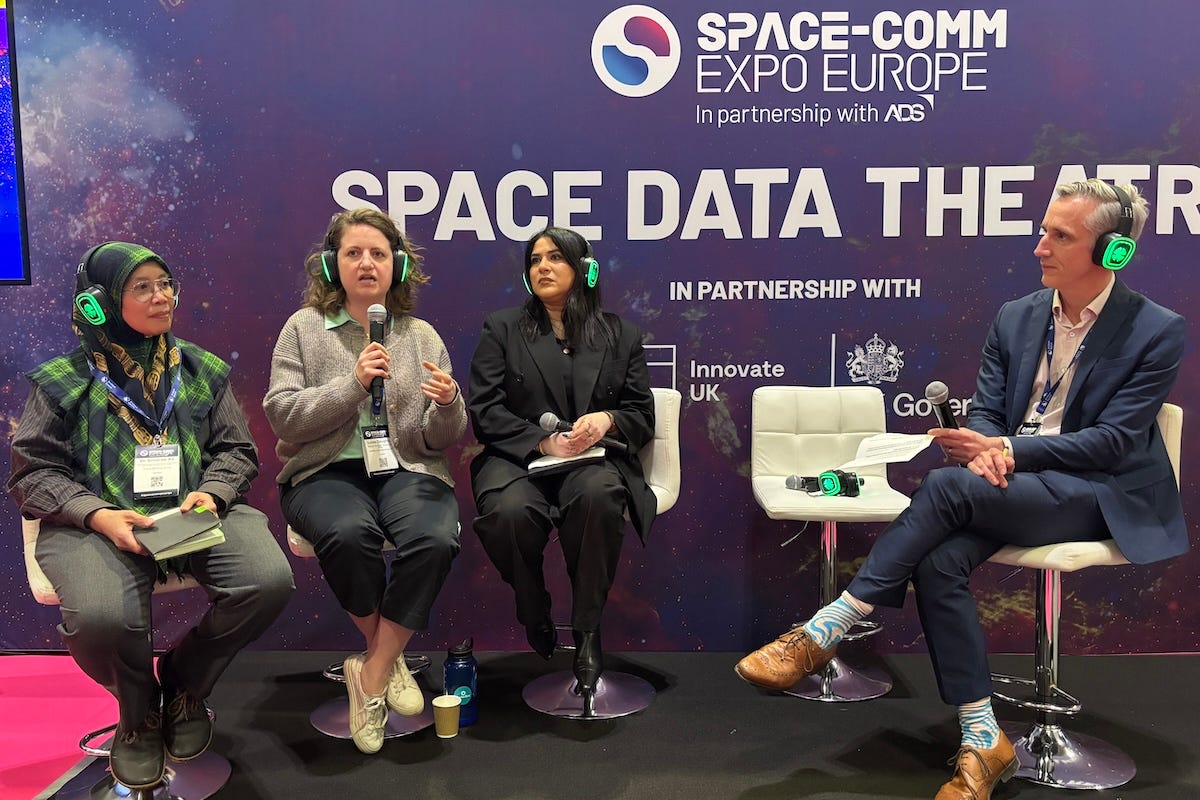
The panel, titled “End User Pull: Unlocking the Commercial Potential of GeoAI,” took place at the 2026 Space-Comm Expo Europe in London, organized by Space-Comm Limited in partnership with ADS Group, the UK trade body for the aerospace, defense, security and space sectors.
It was moderated by Andy Bennett, director of partnerships at Growth Studio, an innovation consultancy.
Ali leads Lloyds’ sustainable food and farming portfolio. Bhattacharjee focuses on bridging coastal ecosystem science, policy and investment at Fugro. Doughty manages the Resilient Earth program at the Satellite Applications Catapult, which works to bring UK space-sector products into mainstream commercial markets.
Doughty said the sector frequently underestimates how varied end-user needs are even within a single organization.
She said GeoAI companies must abandon what she called “space talk” and meet buyers on their own terms, learning the acronyms, frameworks and data stacks of each sector before pitching their technology.
She said the sector often treats “end user” as a singular, but even within one organization there can be 100 different types, from a data team wanting raw datasets to a CEO seeking a simple answer on risk or opportunity.
“A data team may want raw datasets to analyze, while the CEO wants to know: what is the risk, what is the opportunity, almost a yes or no,” she said. “Space is great and very cool, but it is bewildering. Talk the language of whatever market you are targeting.”
Bhattacharjee said the principle applies equally to what buyers actually need from the data. Coming from a finance and nature background, her priority is understanding what the data reveals about ecosystems like seagrass or mangroves and what value it assigns them for investment purposes, rather than the technical mechanisms behind the tools collecting it.
“Whatever we put out needs to be defensible. The conversation around fidelity is important, particularly when funding or market mechanisms are attached,” she said.
Underpinning both the cost and language problem is a more fundamental one: geospatial data has no agreed common standard.
Ali said the issue is data standardization. The sector has lidar, normalized difference vegetation index (NDVI) and all sorts of datasets, but no common standard to share them so that everyone knows what they are working with.
“In a normal database you have a standard. In geospatial, it is bewildering,” she said.
Doughty said government holds data across departments that could help with ground truthing and machine learning model training, but that the sector cannot access it consistently and needs government to create standards and mechanisms for data sharing.
“It should make that data available and help create standards and mechanisms through which data can be shared,” she said.
Government as convener
Doughty said government’s role in the GeoAI ecosystem must go well beyond procurement.
She said there will always be an important role for government, particularly as the sector moves from data collection to commercial deployment at scale.
The Satellite Applications Catapult is core-funded by Innovate UK. The Department for Environment, Food & Rural Affairs (DEFRA) and Innovate UK co-sponsored a GeoAI Build and Pitch program alongside the Space-Comm panel, reflecting a broader push to accelerate the sector’s move from research to commercial readiness.
Ali, who sits on DEFRA’s food and data transparency partnership working group, said government is well-placed to accelerate that shift but must do more on data access. She said much of the data government holds is not openly available and called for greater transparency.
“A lot of it is not transparent. You do not know what data is available here or there. We need somewhere, whether a federated system or a central repository, where we can all use that data as ground truth for machine learning,” she said.
She said DEFRA is also exploring how AI can assist with data curation within the working group.
The cost of getting GeoAI wrong can be high. Bhattacharjee described a case where low-fidelity earth observation data overestimated coastal risk in a privately owned real estate portfolio, with the error flowing directly into mortgage insurance pricing.
“Low-fidelity data leads to mispriced nature-related risk and misguided coastal infrastructure planning,” she said.
Ali said Lloyds had encountered a similar limitation in its real estate portfolio during a Task Force on Nature-related Financial Disclosures (TNFD) pilot. She said geospatial data added little value for real estate managers, for whom flooding risk was already well-served by specialist providers.
The agricultural portfolio proved the far more viable use case, and on the single most-needed intervention to unlock adoption, Bhattacharjee was direct.
“Funding mechanisms for operationalization, not just prototypes, that reward accuracy over experimentation,” she said.
Doughty said procurement cycles are too long, and educating buyers on the benefits of space-based data must be treated as part of the work, not an afterthought.
All three panelists agreed that closing the gap between what space data costs and what end users can justify spending requires government, industry and the supply chain to treat operationalization as a shared goal rather than a problem for the market to solve alone.